![]() The Romans were an industrious bunch, peppering the isles of Britannia with forts, roads and villas and introducing a whole new way of life to a land that already boasted a rich and ancient culture. The story of the Roman invasion is one that still prompts heated debate between historians and archaeologists. Each year, new discoveries are made that add ambiguity to the antiquarian view of a brutal takeover. The supposed war graves of Maiden Castle and the scorched earth of the Boudican revolt contrast sharply with the friendly welcome given to the Legions by the Atrebates in modern Sussex. Clearly, something far more complex was happening in the middle of the first century AD.
The Romans were an industrious bunch, peppering the isles of Britannia with forts, roads and villas and introducing a whole new way of life to a land that already boasted a rich and ancient culture. The story of the Roman invasion is one that still prompts heated debate between historians and archaeologists. Each year, new discoveries are made that add ambiguity to the antiquarian view of a brutal takeover. The supposed war graves of Maiden Castle and the scorched earth of the Boudican revolt contrast sharply with the friendly welcome given to the Legions by the Atrebates in modern Sussex. Clearly, something far more complex was happening in the middle of the first century AD.

The Multiangular Tower in York, the best surviving part of the Roman defences.
In York, we are lucky enough to play home to a wealth of Roman archaeology. Recent discoveries at sites such as Hungate and Driffield Terrace are constantly revising our view of the period. We know that the defences of the city then known as Eboracum were imposing, but we also know that Roman York was flooded with luxury goods from across the empire. As a staging point for military forays to the north and an increasingly important centre of trade, Eboracum reveals an interesting juxtaposition of the military and economic might of the Roman Empire.
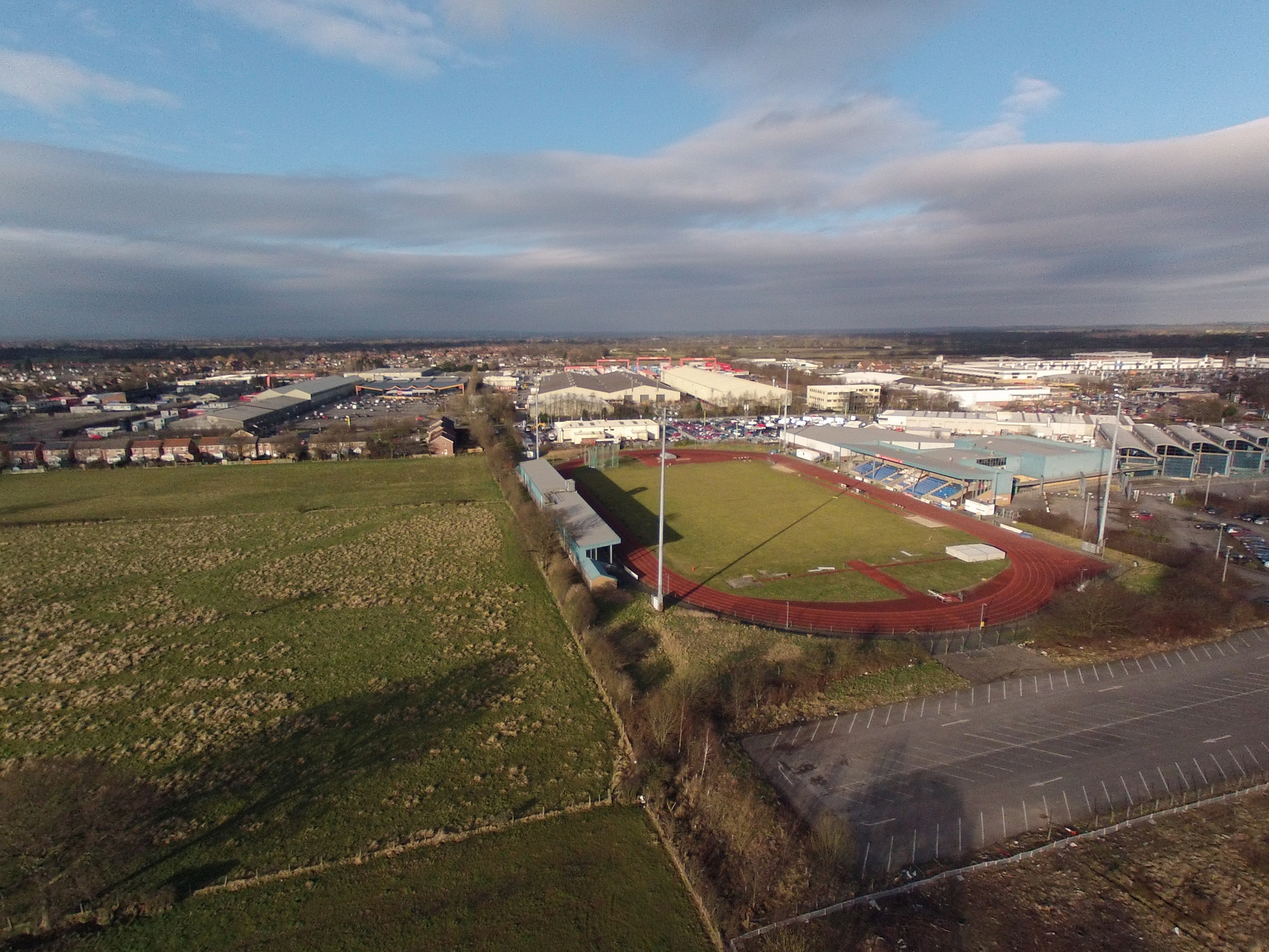
Our Roman camp , visible in earthworks to the left of the stadium. Image courtesy of @watertowers https://www.flickr.com/photos/22260522@N06/with/15950600794/
The Dig York Stadium community archaeology project aims to shed new light on the workings of the Roman city of York and its relationship with its hinterlands. To the north of York, there can be found the remains of many forts and encampments, both permanent and temporary. Our excavation beneath the pitch of Huntington Stadium hopes to locate a Roman camp that has been identified by earthworks visible in aerial photographs. We hope to find out when it was built and why, what evidence remains for activities within the camp and when was it abandoned.
It will be fascinating to be able to suggest whether the camp was used to house troops moving north, or to train soliders based in Eboracum. To do this however, first we must find the fort! You need a bit of luck in archaeology. For a Roman feature to survive in the ground, it must remain untouched by the foundations, drains, ditches, pits and every other intrusion of the intervening centuries. We know that the construction of Huntington Stadium will have damaged the encampment as it was yet to be discovered when the stadium was built. Has all trace of our camp been lost? Enter the geophysics team to find out.

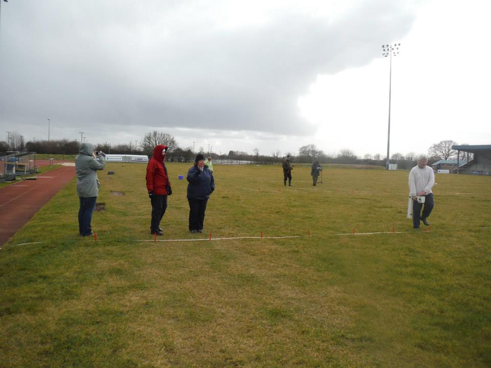
The Day Three geophysics team
During the last week of February we were joined by a team of local volunteers to take a look beneath the pitch and find out whether any archaeological remains are present. The team braved some rather changeable weather and carried out a full geophysical survey of the whole pitch in just three days. Two types of detection were employed – a resistivity meter, which measures the response of an electrical signal sent into the soil and a magnetometer, which detects changes in the magnetic field below the ground.
The team in action, resistivity in the background and the magnetometer in the foreground.
It was immediately apparent that a good amount of material had been stripped to accommodate a bedding layer for the pitch and that numerous drains run beneath the turf. The magnetometer produced somewhat fuzzy results, while the resistance meter detected much stronger responses.
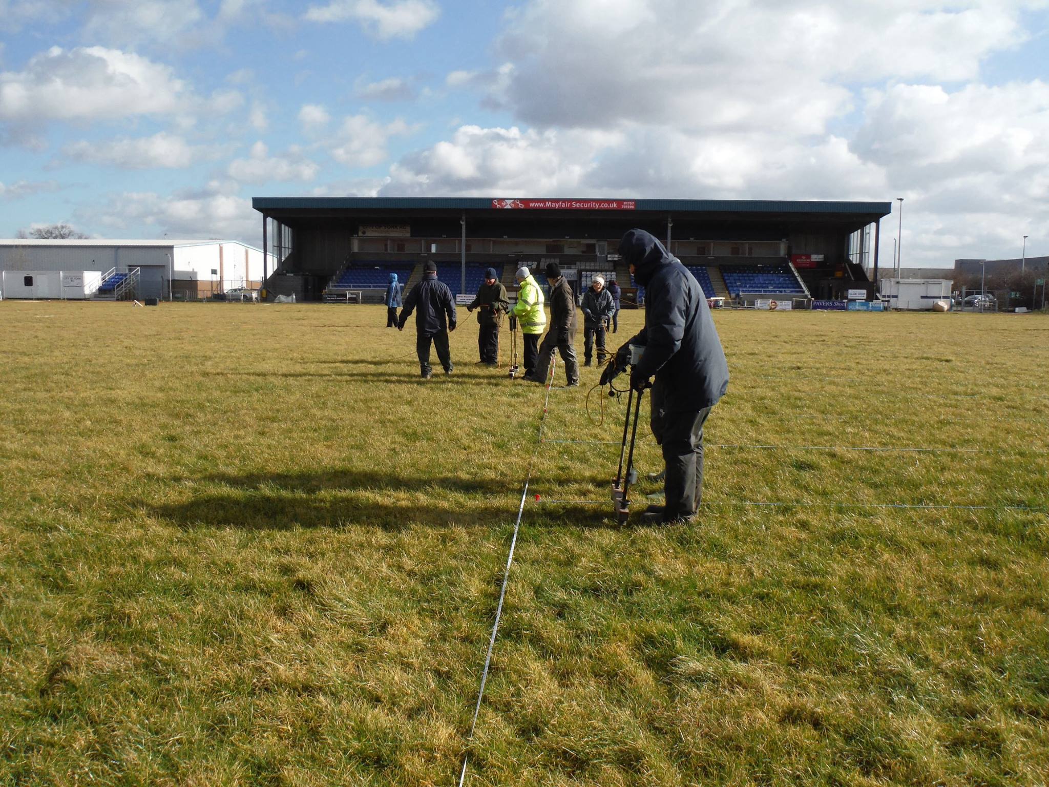
Resistivity survey in action.
The varied results of the survey actually make quite a lot of sense. If a camp is defined by banks and ditches, the backfilled ditches will contain looser material than the surrounding natural clays. As a result, water will move more freely through the ditch backfill and it is this moisture content that will allow an electrical current to pass through it with less resistance. When the readings from the whole pitch are compared, it is possible to see whether or not the responses form a cohesive pattern, such as the line of the ditch.

YAT’s Jon Kenny leading the geophysical charge.
By contrast, the magnetometer seeks changes in magnetic responses in the ground. While disturbed ground (i.e. ditch backfills) will have a slightly different magnetic field to intact natural material, a stronger response will be given by features containing metals, areas of burning and more substantial structures. In short, you’re generally more likely to locate a ditch with resistance survey than magnetometry.
So what did we find?
Here you can see the image produced by the magnetometer survey. As explained above our expectations of a clear and definitive picture of any archaeological remains were not high. This has turned out to be very much the case.
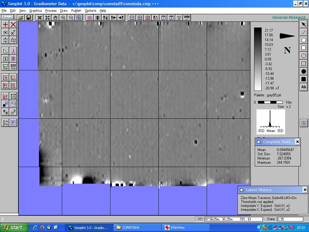
The magnetometer survey results
As luck would have it, the resistivity survey results have been significantly more illuminating. The extent of the survey across the rugby pitch can be seen below.

Resistivity survey results
On first inspection the results of the resistivity survey look a bit fuzzy and inconclusive, but once you get you eye in the image above actually show us quite a lot. Bear in mind that what we are looking for are changes in contrast that reveal trends or patterns. The survey grid consists of squares measuring 20m x 20m. Seen below this and by far the most obvious feature is the rugby pitch itself. This is perhaps not too much of a surprise considering there is around 600mm of compact sand and gravel under the pitch! This bedding material has given a very dark response along the edges of the field, perhaps where it is more compact. The under pitch drainage can be seen as straight pale lines, mostly running across the width of the pitch (top to bottom in the picture), with one or two running the length of the pitch as well. Below you will find a couple of slightly different interpretations of the anomalies that have been identified. One of the great things about archaeology is the scope for different interpretations and the resulting discussions you can have.

Alan Powell’s interpretation of the resistivity survey
The first image is an interpretation kindly provided by Alan Powell. Alan is from the Strensall group and took part in the site survey. Here a curvilinear trend, that for the most part stands out as two pale parallel lines, can been seen to swing across the bottom of the image. This has been highlighted in orange. Alan has also picked out a faint dark trend, this time with a green line. Running from the top right corner of the image towards the bend in the curvilinear trend, this is of particular interest as it lies broadly in line with where we had anticipated one side of the camp to be situated. An alternative take on the survey can be seen below.

Resistivity survey with highlighted trends
Here, the trends that Alan had pointed out have been extrapolated in a slightly different way. Arguably the clearest trend consists of two pale, slightly curving, parallel lines seen near the bottom of the image. Its extent is shown by the green lines and matches with Alan’s interpretation. Much less distinct is a continuous ‘L’ shaped trend consisting of faint lines, which are none the less consistently darker than the readings around them. The area where these run has been highlighted in peach. How might we interpret and understand what these results are indicating? It is tempting to suggest that this ‘L’ shaped trend might be a corner of the camp. It is certainly in about the right location and it forms a right angle, more or less. The position of this anomaly is further towards the middle of the rugby pitch than we had anticipated; one suggestion is that what we can see are the remnants of the bank rather than the camp ditch.
We know that the underlying geology is very clayey, as such it is possible that the ditch has infilled with that sort of material. The result being that there is little contrast to be seen differentiating between the infilled ditch and the surrounding clayey geological material. The curvilinear trend, highlighted in green, looks as though it deviates around the camp, and as such this is could be taken as an indication that it is likely later than the camp. This leaves us with plenty to ponder over and aid the planning of the excavation strategy. So all in all a great result from all of the hard work done by the survey team. Many thanks for all your efforts!
– Arran and Ben
